ബീദർ ജില്ല
കർണ്ണാടകസംസ്ഥാനത്തിലെ ജില്ല
(Bidar district എന്ന താളിൽ നിന്നും തിരിച്ചുവിട്ടതു പ്രകാരം)
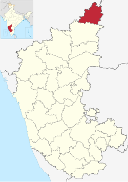
കർണാടകയിലെ 31 ജില്ലകളിൽ ഒന്നാണ് ബീദർ ജില്ല(Bidar district). കർണാടയുടെ ഏറ്റവും വടക്കായി സ്ഥിതി ചെയ്യുന്ന ഈ ജില്ലയുടെ അതിർത്തികൾ കിഴക്ക് തെലംഗാണയിലെ കാമറെഡ്ഡി സംഗറെഡ്ഡി ജില്ലകൾ, പടിഞ്ഞാറ് മഹാരാഷ്ട്രയിലെ ലത്തൂർ, ഒസ്മാനബാദ് ജില്ലകൾ, വടക്ക് മഹാരാഷ്ട്രയിലെ നന്ദെദ് ജില്ല തെക്ക് ഗുൽബർഗ ജില്ല എന്നിവയാകുന്നു.
ബീദർ ജില്ല | |||||||
|---|---|---|---|---|---|---|---|
Clockwise from top-left: Bidar Fort, Tombs of the Bahmani Sultans in Ashtur, Akka Nagamma Cave in Basavakalyan, Blackbuck sanctuary, Kamaleshwara Temple | |||||||
| Nicknames: Crown of Karnataka, Northeast Gateway of Karnataka, Sorghum Land | |||||||
 Location in Karnataka | |||||||
| Country | |||||||
| State | Karnataka | ||||||
| Headquarters | ബീദർ | ||||||
| Division | Kalyana Karnataka | ||||||
| Founded | 1 നവംബർ 1956 | ||||||
| MP | Bhagwanth Khuba (BJP) | ||||||
| Deputy Commissioner | Govinda Reddy | ||||||
| Constituency | One: Bidar (Lok Sabha constituency) | ||||||
| • ഭരണസമിതി | Zilla Panchayat | ||||||
| • Total | 5,448 ച.കി.മീ.(313 ച മൈ) | ||||||
| • നഗരം | 165 ച.കി.മീ.(2,586 ച മൈ) | ||||||
| • ഗ്രാമീണ പ്രദേശം | 5,283 ച.കി.മീ.(242 ച മൈ) | ||||||
| • Forest cover | 436 ച.കി.മീ.(168 ച മൈ) | ||||||
| • Land | 1,50,981 ച.കി.മീ.(58,294 ച മൈ) | ||||||
| ഉയരം | 615 മീ(2,018 അടി) | ||||||
| ഉയരത്തിലുള്ള സ്ഥലം | 715 മീ(2,346 അടി) | ||||||
(2011)[1] | |||||||
| • Total | 17,03,300 | ||||||
| • കണക്ക് (2021)[3] | 19,27,828 | ||||||
| • റാങ്ക് | 287 (out of 640) | ||||||
| • ജനസാന്ദ്രത | 310/ച.കി.മീ.(5,400/ച മൈ) | ||||||
| • നഗരപ്രദേശം | 4,25,952 | ||||||
| • നഗര സാന്ദ്രത | 165/ച.കി.മീ.(2,586/ച മൈ) | ||||||
| • ഗ്രാമപ്രദേശം | 1,277,348 | ||||||
| • ഗ്രാമ സാന്ദ്രത | 5,283/ച.കി.മീ.(242/ച മൈ) | ||||||
| • Male Population | 8,70,665 | ||||||
| • Male Population density | 159/ച.കി.മീ.(410/ച മൈ) | ||||||
| • Female Population | 8,32,635 | ||||||
| • Female Population density | 153/ച.കി.മീ.(400/ച മൈ) | ||||||
| • per 1000 males | 956 females | ||||||
| • in the age group 0-6 | 942 | ||||||
| • Average | 70.51% | ||||||
| • Male | 79.09% | ||||||
| • Female | 61.55% | ||||||
| സമയമേഖല | UTC+5:30 (IST) | ||||||
| Pin Code | 585XXX | ||||||
| Telephone Code | +91-(0)8482 XXXXXX | ||||||
| ISO കോഡ് | IND-KA | ||||||
| വാഹന റെജിസ്ട്രേഷൻ |
| ||||||
| Hobli(s) | 30 | ||||||
| Taluka(s) | Aurad, Basavakalyan, Bhalki, Humnabad, Chitgoppa, Kamalnagar, Hulsoor, Bidar | ||||||
| Zilla Panchayat Member(s) | 34 | ||||||
| Taluka Panchayat Member(s) | 131 | ||||||
| Gram Panchayat Member(s) | 3314 | ||||||
| MLC | 04 | ||||||
| Airport | Bidar | ||||||
| Gram Panchayat(s) | 186 | ||||||
| MLA | 06 | ||||||
| Taluka(s) | 08 | ||||||
| Railway Station | Bidar | ||||||
| Headquarters | Bidar | ||||||
| South MLA | Bandeppa Kashempur | ||||||
| Precipitation | 847 മില്ലിമീറ്റർ (33.3 ഇഞ്ച്) | ||||||
| No. of villages | 699 | ||||||
| വെബ്സൈറ്റ് | bidar | ||||||
ജില്ലയുടെ ആസ്ഥാനം ബീദർ നഗരമാണ്. ദേശീയപാത 65 (നേരത്തെ ദേശീയപാത 9), ദേശീയപാത 50 എന്നിവ ഈ ജില്ലയിലൂടെ കടന്നുപോകുന്നു.


