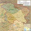
പ്രമാണം:Kashmir Region November 2019.jpg

ഈ പ്രിവ്യൂവിന്റെ വലിപ്പം: 604 × 599 പിക്സലുകൾ. മറ്റ് റെസലൂഷനുകൾ: 242 × 240 പിക്സലുകൾ | 484 × 480 പിക്സലുകൾ | 774 × 768 പിക്സലുകൾ | 1,033 × 1,024 പിക്സലുകൾ | 1,579 × 1,566 പിക്സലുകൾ.
പൂർണ്ണ വലിപ്പം (1,579 × 1,566 പിക്സൽ, പ്രമാണത്തിന്റെ വലിപ്പം: 1.44 എം.ബി., മൈം തരം: image/jpeg)
പ്രമാണ നാൾവഴി
ഏതെങ്കിലും തീയതി/സമയ കണ്ണിയിൽ ഞെക്കിയാൽ പ്രസ്തുതസമയത്ത് ഈ പ്രമാണം എങ്ങനെയായിരുന്നു എന്നു കാണാം.
| തീയതി/സമയം | ലഘുചിത്രം | അളവുകൾ | ഉപയോക്താവ് | അഭിപ്രായം | |
|---|---|---|---|---|---|
| നിലവിലുള്ളത് | 09:14, 2 ജൂൺ 2022 |  | 1,579 × 1,566 (1.44 എം.ബി.) | Fowler&fowler | Reverted to version as of 04:58, 21 February 2022 (UTC) Again and for the last time, there is a WikiProjects India, Pakistan, and China consensus for this file to only appear in this form. It cannot be changed to highlight one portion or other for any of the subdivisions. If you persist, I will request administrative action |
| 14:44, 26 ഏപ്രിൽ 2022 |  | 1,579 × 1,566 (2.15 എം.ബി.) | Aréat | updated the key. What's the problem with the colors for the up to date situation? It's a public domain file | |
| 04:58, 21 ഫെബ്രുവരി 2022 |  | 1,579 × 1,566 (1.44 എം.ബി.) | Fowler&fowler | Reverted to version as of 14:08, 4 January 2021 (UTC). Sorry by a WikiProjects India-Pakistan consensus we cannot change the CIA maps and its colors; see "Indian-administered" color map on the top right. | |
| 04:04, 6 ഏപ്രിൽ 2021 |  | 1,579 × 1,566 (2.09 എം.ബി.) | Aréat | Distinct colors for Ladakh and Jammu and Kashmir, sicne the map is used on their page, and the map as it was made it hard to see what their respective territory is | |
| 14:08, 4 ജനുവരി 2021 |  | 1,579 × 1,566 (1.44 എം.ബി.) | Sbb1413 | Updated to include modern-day names of some provinces and states (e.g. North Western Frontier Province is now called Khyber Pakhtunkhwa, Uttaranchal is now called Uttarakhand). | |
| 06:13, 3 ഡിസംബർ 2020 |  | 1,579 × 1,566 (1.27 എം.ബി.) | Sbb1413 | Reverted to version as of 16:29, 25 November 2019 (UTC) | |
| 06:05, 3 ഡിസംബർ 2020 |  | 2,469 × 2,449 (1,023 കെ.ബി.) | Sbb1413 | Added working boundary from File:File:Kashmir map big.jpg, also from CIA. | |
| 16:29, 25 നവംബർ 2019 |  | 1,579 × 1,566 (1.27 എം.ബി.) | Fowler&fowler | Moving labels to less cluttered spots; making Aksai Chin as big as other labels; drawing the J&K and Ladakh boundaries in green as indicated in info on the top left; making that info conform to the name change: Northern Areas-->Gilgit-Baltistan | |
| 06:29, 14 നവംബർ 2019 |  | 1,579 × 1,567 (1.35 എം.ബി.) | Fowler&fowler | User created page with UploadWizard |
പ്രമാണത്തിന്റെ ഉപയോഗം
താഴെ കാണുന്ന 5 താളുകളിൽ ഈ ചിത്രം ഉപയോഗിക്കുന്നു:
പ്രമാണത്തിന്റെ ആഗോള ഉപയോഗം
താഴെ കൊടുത്തിരിക്കുന്ന മറ്റ് വിക്കികൾ ഈ പ്രമാണം ഉപയോഗിക്കുന്നു:
- ar.wiki.x.io സംരംഭത്തിലെ ഉപയോഗം
- as.wiki.x.io സംരംഭത്തിലെ ഉപയോഗം
- az.wiki.x.io സംരംഭത്തിലെ ഉപയോഗം
- ba.wiki.x.io സംരംഭത്തിലെ ഉപയോഗം
- bn.wiki.x.io സംരംഭത്തിലെ ഉപയോഗം
- ca.wiki.x.io സംരംഭത്തിലെ ഉപയോഗം
- de.wiki.x.io സംരംഭത്തിലെ ഉപയോഗം
- de.wikivoyage.org സംരംഭത്തിലെ ഉപയോഗം
- en.wiki.x.io സംരംഭത്തിലെ ഉപയോഗം
- Territorial dispute
- Line of Control
- Baltistan
- Line of Actual Control
- Skardu
- Trans-Karakoram Tract
- Talk:List of ongoing armed conflicts
- Dominion of India
- Kashgar Prefecture
- Frozen conflict
- History of Ladakh
- Talk:Robin Raphel
- Sino-Indian border dispute
- List of active separatist movements in Asia
- History of Azad Kashmir
- Jammu division
- Ministry of Kashmir Affairs and Gilgit-Baltistan
- Wikipedia talk:Noticeboard for India-related topics/Archive 69
- Talk:Ladakh/Archive 1
- Wikipedia talk:WikiProject Maps/Archive 2020
- User:DutchTreat/Projects/Maps
- Wikipedia:Noticeboard for Kashmir-related topics
- Portal:Kashmir
- Portal:Kashmir/Intro
- User talk:Kautilya3/Archives/Archive 17
- Talk:Azad Kashmir/Archives/2021
- Talk:Jammu and Kashmir (union territory)/Archive 1
ഈ പ്രമാണത്തിന്റെ കൂടുതൽ ആഗോള ഉപയോഗം കാണുക.


